081
位置圖 Location
蘆 鬚 城 休 憩 處
Lo So Shing Sitting-out Area
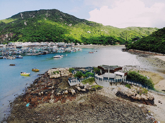
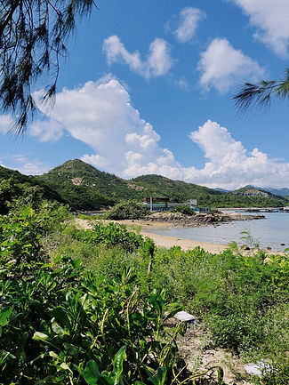
南丫島的南段索罟灣,因當地漁民以魚網(罟)來捉魚而得名。在索罟灣的最深處有一村落,近似地,因當地村民耕種蘆鬚菜(即南瓜苗)而得名蘆鬚城。早於1970年代,在蘆鬚城海灘近岸的平岩上已建有涼亭,但並沒有步道登岸,直至1993年,原址建成休憩處,修築長約45米的步道連接沙灘,並後於2009年再次翻新涼亭。休憩處以大型三角造型的涼亭為中心,設有三個形狀各異的平台依附於礁石上,通過巧妙的樓梯連接與跨越,成網狀扣於海天之間。海桐圍繞著台地恣肆生長,與沙灘、海浪、漁排構成壯闊開朗的風景。利用各台地不同朝向和高差,結合滿足休憩功能的木質桌椅,遊人可沉浸於此地飽覽索罟灣和遠眺港島南鴨脷洲景致。
Sok Ku Wan of southern Lamma Island is named after fish nets (Kwu) used by local fishermen. Similarly, Lo So Shing, a village in the deepest part of Sok Ku Wan, is named after villagers planting pumpkin seedlings (Lo So Choi). A pavilion was built on flat rocks along the outer coastline of Lo So Shing’s eastern beach in the 1970s, yet there was no path leading to the rock at the time. In 1993, when the site was designated as a sitting-out area, a 45-metre-long walkway was built to connect the beach and the rock. The pavilion was renovated in 2009. The sitting-out area is centred on a large triangular-shaped pavilion. Delicate staircases connect the pavilion with three platforms of different shapes and height. Pittosporum tobira Ait grows freely around the platforms, forming an open and magnificent landscape with the beach, waves and fishing rafts. Equipped with platforms of different orientations and heights, wooden tables and chairs, the site allows the visitors to immerse themselves in this coastal landscape, enjoying the view of Sok Ku Wan and the distant view of south Ap Lei Chau on Hong Kong Island.

剖面圖 Section
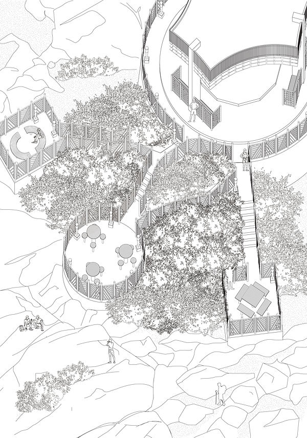
軸測圖 Axonometric