068
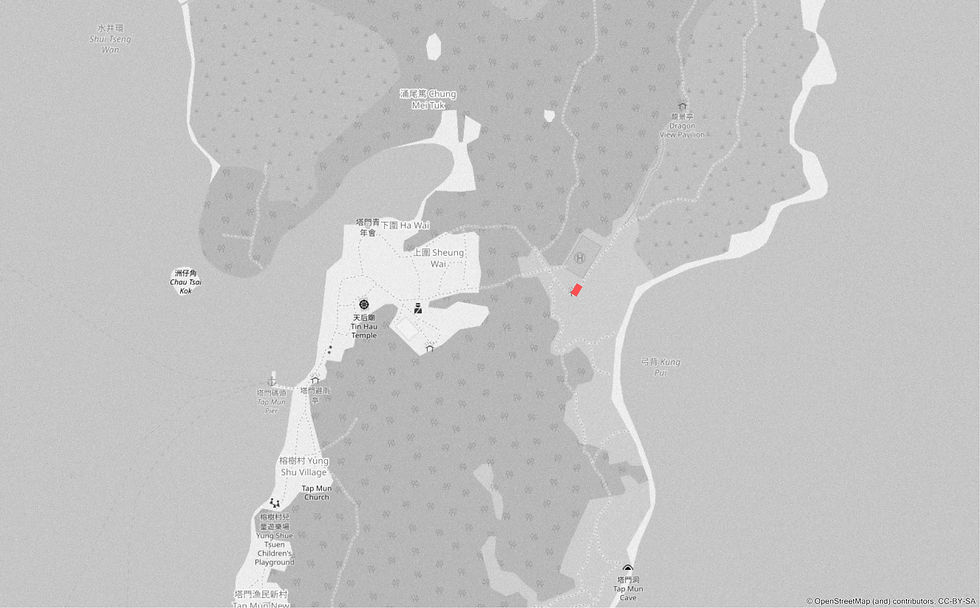
位置圖 Location
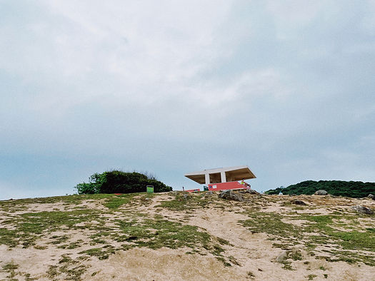
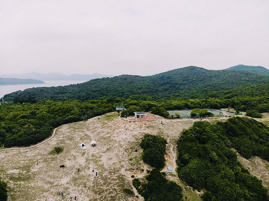
塔 門 休 憩 處
Tap Mun Sitting-out Area
塔門,官方英文名稱作草島,是香港東北一個島嶼,地處赤門海峽和大鵬灣之間,被郊野公園環繞。其名字最早記載於明朝萬曆年間的《粵大記》,作為惠潮到廣州府海路的中途補給點,已有數百年歷史。休憩處位於塔門營地的制高點,海拔約35米,設計為一個建於長寬約17乘9.5米的台地上的方亭,並有階梯座椅,西靠一幅樹林,東朝大鵬灣。海天一色的大鵬灣廣袤無際,卻又可被樑柱以框景的形式拉入涼亭內遊人的視野中。牛隻於草坪上隨心走動覓食,草坡下的湧浪拍打峭壁,海浪聲在不遠處迴蕩,構成酣暢的視聽體驗。絕佳的景色和平緩的草原,讓塔門成為熱門的觀賞日出和露營地點,但由於缺乏露營設施、淡水資源和遊人環保意識及責任感匱乏,近年草坪沙漠化愈趨嚴重,人類活動對草原的破壞令塔門牛的生存處境變得困難。
Tap Mun, officially known as Grass Island, is an island in the northeast of Hong Kong, situated between Tolo Channel and Mirs Bay, and surrounded by country parks. Its name was first recorded in “Grand record of Guangdong” written by the late Ming-period. The island has been used for centuries as a midway supply point on the sea route from Wai Chiu to Canton. The main feature of this Sitting-Out Area is a square pavilion located on a terrace of approximately 17 metres by 9.5 metres with stepped seating. The site is set against a woodland to the west and facing Mirs Bay to the east. The vast expanse of Mirs Bay is framed by pillars of the pavilion. With cattle freely grazing in the fields, waves lapping the cliffs and the sound of the waves echoing in the distance, the site offer its visitors an unique audio-visual experience. However, in recent years, the lack of camping facilities, freshwater resources and a lack of environmental awareness and responsibility on the part of visitors has led to increased desertification. The damage to the grasslands due to human activities has made the survival of the Tap Mun cattle difficult.
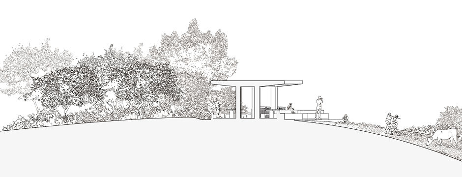
剖面圖 Section

軸測圖 Axonometric